Skip to content
wheretotravel.info
Cayambe

Cayambe travel guide

What to see, where to stay and the best time to visit Cayambe, Ecuador.

Best: Aug

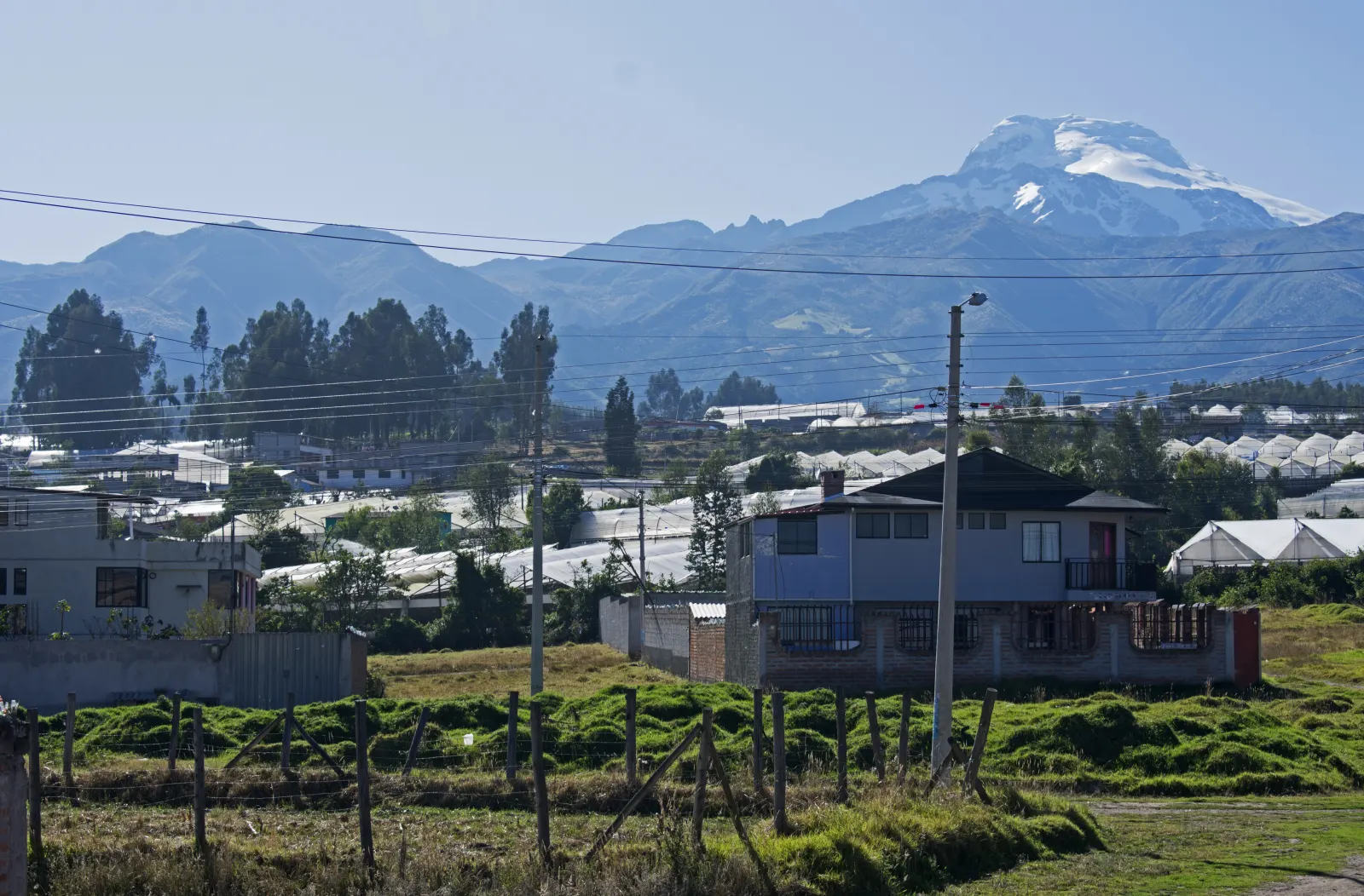
Photo: Ymblanter / Wikimedia Commons

Country
Ecuador
Currency
USD

About Cayambe

Cayambe is a small Andean town in Ecuador, sitting almost exactly on the equator and in the shadow of the snow-capped Cayambe volcano. It's a base for exploring equator monuments, old haciendas, and quiet highland villages rather than a place with big city sights. Visitors come for the Quitsato Sundial, local bakeries famous for bizcochos, and countryside around Cangahua and Olmedo. August is the best month to visit, with clearer mountain views.

How many days do you need in Cayambe?

Two days are enough to see Cayambe town, the Quitsato Sundial, and one nearby site like Hacienda Guachalá or Pucará de Quitoloma without rushing.

Top attractions in Cayambe

  1. 1Quitsato Sundial (Mitad del Mundo Quitsato)

    1–2 hours

    Quitsato, south of Cayambe

    A large sundial built exactly on the equator line, with guides who explain how ancient Andean cultures tracked the sun and the seasons. It is a quieter, more scientific alternative to the better-known equator monument near Quito.

  2. 2Hacienda Guachalá

    2–3 hours

    Cangahua

    One of the oldest haciendas in Ecuador, with colonial courtyards, a chapel and a small museum about rural life in the highlands. You can walk the grounds, have lunch or stay the night.

  3. 3Puntiachil Archaeological Site

    1–2 hours

    Juan Montalvo, Cayambe

    Earth mounds and terraces from the Cayambi people and the Inca period, on a hill just outside town. A small visitor centre explains the site, which is thought to have been used for ceremonies and watching the sun.

  4. 4Pucará de Quitoloma

    Half a day

    Cangahua

    The remains of an Inca hilltop fortress with stone walls, set high in the páramo inside Cayambe Coca National Park. Reaching it involves a dirt road and a steep walk, and it is often cold, windy and misty, so bring warm layers.

  5. 5Laguna de San Marcos

    2–3 hours

    Olmedo

    A calm lake at the foot of Cayambe Volcano, surrounded by páramo grassland and farmland. It is a good place for a picnic, a walk along the shore and, on clear mornings, views of the snowy peak.

  6. 6Oyacachi Hot Springs

    Full day

    Oyacachi

    Thermal pools in a small Kichwa village on the eastern side of the Andes, reached by a long mountain road from Cayambe through the national park. The drive crosses high páramo before dropping into cloud forest.

  7. 7Bizcocho Bakeries

    1 hour

    Cayambe town

    Cayambe is famous across Ecuador for bizcochos, crisp baked biscuits made in wood-fired ovens. Stop at one of the bakeries in town to try them warm with queso de hoja (a soft local cheese) and dulce de leche.

  8. 8Parque Central and Main Church

    1 hour

    Cayambe town centre

    The main square is the centre of town life, with gardens, benches and the town's main church on one side. It is a good starting point for a walk and for seeing everyday highland life.

Cayambe by month

Average weather and our month score, from 10 years of climate data.

Weather by month and month scores for Cayambe
Month High / low Rain days Sunshine Score
January 18°C / 8°C 26 days (261 mm) 9.9 h/day 6.9/10
February 18°C / 9°C 25 days (246 mm) 9.7 h/day 6.9/10
March 18°C / 9°C 29 days (342 mm) 9.2 h/day 6.8/10
April 18°C / 9°C 29 days (352 mm) 9.8 h/day 6.9/10
May 18°C / 9°C 26 days (300 mm) 10.0 h/day 6.9/10
June 18°C / 8°C 23 days (209 mm) 10.4 h/day 6.9/10
July 18°C / 8°C 16 days (125 mm) 10.6 h/day 6.9/10
Best month: August 19°C / 8°C 13 days (97 mm) 11.0 h/day 7.5/10
September 19°C / 7°C 16 days (110 mm) 11.0 h/day 7.0/10
October 19°C / 8°C 26 days (242 mm) 10.3 h/day 7.0/10
November 18°C / 8°C 26 days (257 mm) 9.9 h/day 7.0/10
December 18°C / 8°C 27 days (287 mm) 10.3 h/day 6.9/10
  1. Jan

    High 17.7°C, with rain on 25.6 days and 261 mm in total. Scores rate it good, but expect rain on most days.

  2. Feb

    High 17.8°C, with rain on 25.3 days and 246 mm. Rated good, though it is still wet. Pack a rain jacket.

  3. Mar

    High 17.6°C, with rain on 28.9 days and 342 mm. Still rated good, but it has the most rain days of the year.

  4. Apr

    High 17.8°C, with rain on 28.7 days and 352 mm, the most rain of the year. Rated good, yet hikers should pick a drier month.

  5. May

    High 17.9°C, with rain on 26.4 days and 300 mm. Rated good, but it is still one of the wetter months.

  6. Jun

    High 17.7°C. Rain days drop to 22.5, with 209 mm. Rated good as the drier months begin.

  7. Jul

    High 17.7°C, with rain on only 15.8 days and 125 mm. There are 10.6 sun hours a day. Rated good and much drier.

  8. Aug

    The best month, with a score of 7.5. High 18.6°C, with the fewest rain days at 12.6, only 97 mm and 11 sun hours.

  9. Sep

    The warmest high at 19.3°C, but the coolest nights at 7.4°C. Rain on 15.9 days, 110 mm. Rated good, with a score of 7.

  10. Oct

    High 18.6°C, but rain days jump to 26, with 242 mm. Rated good, with a score of 7, though the wet season is back.

  11. Nov

    High 18°C, with rain on 26.2 days and 257 mm. Rated good, with a score of 7, but expect frequent showers.

  12. Dec

    High 17.9°C, with rain on 27 days and 287 mm. Rated good, but it is one of the wetter months, so plan for rain.

Climate averages 2015–2024 · Best time to visit Ecuador →

Where to stay in Cayambe

The best areas to base yourself and who each one suits.

Centro

Good for first-timers, short stays, no car

The town centre around the main square and church is the easiest base, with bakeries selling the local bizcochos, shops, places to eat and buses to Quito and Otavalo close by. Most visitors can walk to everything they need here. The Panamericana highway runs through town, so rooms near the main roads can get traffic noise.

Ayora

Good for quiet stays, rural views

Ayora is a parish just north of the town centre, surrounded by farmland and flower greenhouses with views of the volcano on clear mornings. It feels calmer than central Cayambe while staying close to it. Evenings are very quiet, and you will rely on taxis or local buses to reach restaurants in town.

Cangahua

Good for history lovers, equator sites, countryside

This rural parish south of town is close to old haciendas and to sites linked to the equator line. It suits travellers who want space, Andean village life and fresh highland air. It is spread out and far from most services, so having your own transport makes life much easier.

Olmedo

Good for community tourism, slow travel

Olmedo lies on the higher slopes north-east of Cayambe, among Indigenous farming communities and páramo grassland. It is a good choice if you want homestays and walks away from the highway. Nights are colder at this altitude, and bus links to the town centre are less frequent.

Getting to and around Cayambe

From the airport
Cayambe has no major airport of its own. Most visitors arrive via Quito's international airport and continue by road, usually by bus, shared shuttle or taxi, since no specific route data is available for this leg.
Public transport
Cayambe has little formal public transport. Local buses connect the town with surrounding areas like Cangahua and Olmedo, but services are limited. Taxis are the practical option for reaching outlying sites such as Hacienda Guachalá or Quitsato Sundial.
On foot
Cayambe town centre is small and walkable. The Parque Central, Main Church, Puntiachil Archaeological Site and Bizcocho Bakeries all sit within Cayambe town, making a short walking loop easy for a first-timer.

Food to try in Cayambe

Bizcochos de Cayambe

Long, crunchy biscuits baked in wood-fired ovens, the snack the town is best known for. Locals and passing drivers buy them warm from bakeries along the main road and eat them with coffee or hot chocolate.

Queso de hoja

A soft, fresh cheese stretched into thin sheets and rolled up, often wrapped in a leaf. It comes from the dairy farms around town and is usually eaten with bizcochos.

Manjar de leche

A thick, sweet milk caramel made from local milk. People spread it on bizcochos or buy jars to take home, often from the same shops that sell the biscuits.

Fritada

Pieces of pork slowly cooked in their own fat until crisp, served with mote (boiled corn), potatoes and roasted corn. It is a common weekend and family meal in the Andean towns of the area.

Chicha de jora

A mildly fermented drink made from sprouted maize. In Cayambe it is closely tied to the Inti Raymi and San Pedro festivals, when it is shared during dances and community gatherings.

More of Ecuador

Ecuador travel guide →

Cayambe: frequently asked questions

Is August a good time to visit Cayambe?

Yes, August is the best month, with a score of 7.5. It has only 12.6 rain days and 97 mm of rain, plus 11 hours of sun, the highest sunshine total of the year. Daytime highs reach 18.6°C, so it's a dry, bright month for exploring the area.

Is March a wet month in Cayambe?

Yes, March is one of the wettest months. It averages 28.9 rain days and 342 mm of rain, with only 9.2 hours of sun, the lowest sunshine figure of the year. Daytime highs still sit near 17.6°C, so temperatures stay mild even with frequent rain.

When is the dry season in Cayambe?

The driest stretch runs from July to September. July has 125 mm of rain over 15.8 days, August drops to 97 mm over 12.6 days, and September sees 110 mm over 15.9 days. Sun hours climb to 10.6–11 in these months, making this the clearest period of the year.

How many days do I need in Cayambe?

Two days cover the main sights comfortably. The Quitsato Sundial and Puntiachil site each take 1–2 hours, Hacienda Guachalá and Laguna de San Marcos need 2–3 hours, and Pucará de Quitoloma or the Oyacachi Hot Springs each take a half or full day. Splitting these across two days avoids rushing.

Is Cayambe cold at night?

Yes, nights are cool throughout the year. Overnight lows range from 7.4°C in September to 9.0°C in February, so pack warm layers regardless of when you visit. Daytime highs stay close to 17.6–19.3°C, giving a noticeable day-to-night temperature swing typical of this elevation.