Skip to content
wheretotravel.info
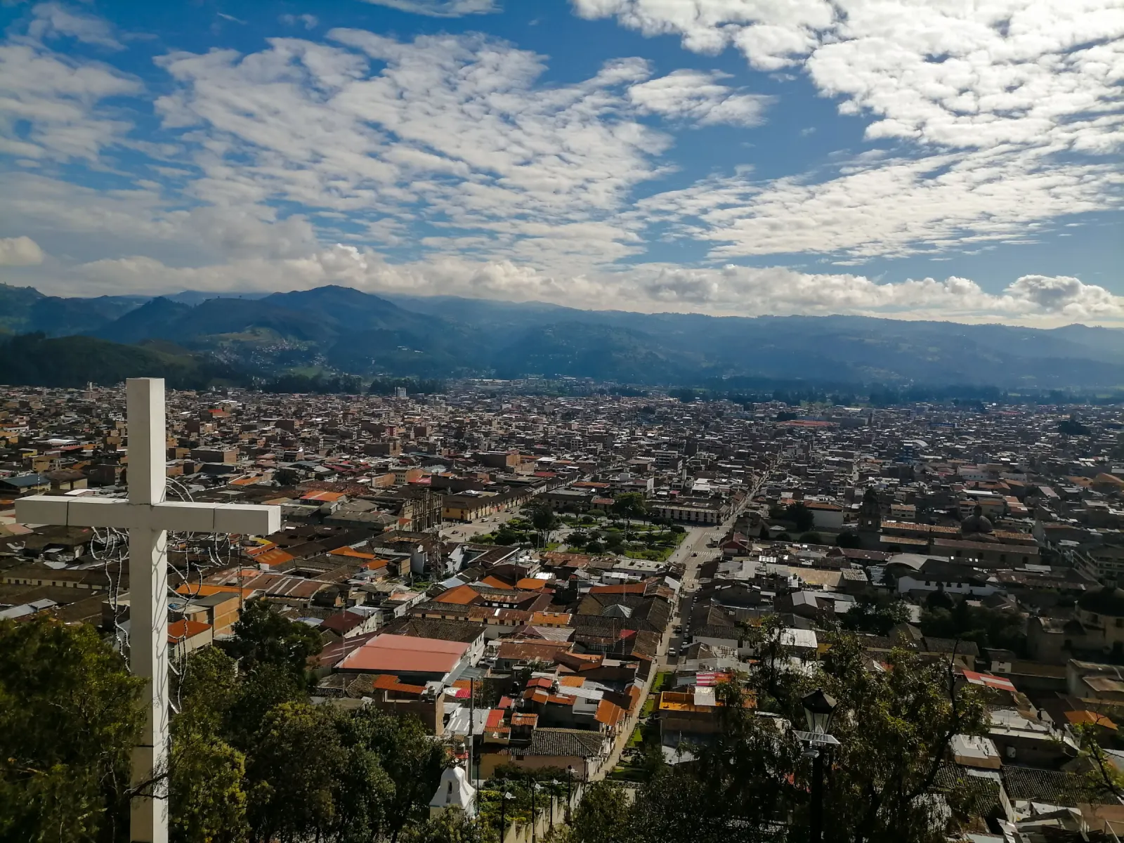
city view from hill with white cross

Quetzaltenango travel guide

What to see, where to stay and the best time to visit Quetzaltenango, Guatemala.

Best: Jan, Feb

Photo: David Diaz / Pexels

Country
Guatemala

About Quetzaltenango

Quetzaltenango, often called Xela, is Guatemala's second city and sits in the highlands, far from the coast. It has a compact centre around Parque Centroamérica, with a cathedral, a theatre and a large cemetery to explore on foot. Beyond the city, volcanoes, crater lakes and hot springs give visitors reasons to stay longer. January and February bring the best weather, with drier, clearer days that suit hiking trips like the climb up Santa María Volcano.

How many days do you need in Quetzaltenango?

The city centre's sights fill a day or two, but add time for day trips to Fuentes Georginas, Laguna Chicabal or Zunil, each needing half a day, plus a full day for Santa María Volcano.

Top attractions in Quetzaltenango

  1. 1Parque Centroamérica

    1–2 hours

    Zona 1 (city centre)

    The main square of Xela, framed by grand neoclassical buildings, banks and the old Pasaje Enríquez arcade. It is the natural starting point for a walk around the historic centre and a good place to watch local life.

  2. 2Catedral del Espíritu Santo

    30 minutes–1 hour

    Zona 1 (Parque Centroamérica)

    The city's cathedral stands on the east side of the central square. The ornate facade of the original colonial church survives in front of a newer building behind it, and that contrast is the main reason to look closely.

  3. 3Teatro Municipal

    30 minutes–1 hour

    Zona 1

    A neoclassical theatre a short walk north of the central square, with columns and busts of national figures outside. It is one of the city's finest buildings and still hosts performances.

  4. 4Cementerio General

    1–2 hours

    Zona 3

    A large city cemetery full of colourful family tombs, mausoleums and monuments. It gives a quiet look at local history and Guatemalan traditions around death and remembrance.

  5. 5Cerro El Baúl

    1–2 hours

    Edge of the city

    A wooded hill and park on the edge of town with walking paths and views over Xela and the surrounding volcanoes. It is an easy outing for a city break without a full hike.

  6. 6Santa María Volcano

    Full day (start before dawn)

    South of the city

    The volcano that rises over Xela is the classic local hike, steep but without technical climbing. From the top you can look down on the active Santiaguito dome and across a long chain of volcanoes. Clouds often roll in later in the morning, so most groups start in the dark.

  7. 7Laguna Chicabal

    Half a day

    Near San Martín Sacatepéquez

    A crater lake inside a volcano, surrounded by cloud forest and often wrapped in mist. It is a sacred site for local Maya communities, and it sometimes closes to visitors for ceremonies. Visitors are expected to be quiet and respectful.

  8. 8Fuentes Georginas

    Half a day

    Near Zunil

    Natural hot springs fed into pools on a steep, forested mountainside. The air up here is cool and often misty, which makes the warm water especially pleasant.

  9. 9Zunil

    1–2 hours

    Zunil (outside the city)

    A K'iche' Maya town in a green valley below the road to Fuentes Georginas, with a white colonial church and farm fields all around. Many visitors stop here on the way to the hot springs.

  10. 10San Andrés Xecul Church

    1–2 hours

    San Andrés Xecul (outside the city)

    A small town known for its bright yellow church facade, covered in painted figures, plants and animals. It is one of the most photographed churches in Guatemala and an easy trip from Xela.
Quetzaltenango by month

Average weather and our month score, from 10 years of climate data.

Weather by month and month scores for Quetzaltenango
Month High / low Rain days Sunshine Score
Best month: January 18°C / 8°C 14 days (43 mm) 10.8 h/day 7.2/10
Best month: February 19°C / 9°C 14 days (47 mm) 11.0 h/day 7.2/10
March 19°C / 9°C 23 days (107 mm) 11.3 h/day 7.0/10
April 19°C / 11°C 26 days (190 mm) 11.1 h/day 7.0/10
May 19°C / 12°C 30 days (378 mm) 9.7 h/day 7.0/10
June 18°C / 12°C 28 days (452 mm) 8.3 h/day 7.0/10
July 19°C / 11°C 24 days (215 mm) 10.3 h/day 7.0/10
August 19°C / 11°C 27 days (300 mm) 9.8 h/day 7.0/10
September 18°C / 12°C 29 days (400 mm) 8.9 h/day 7.0/10
October 18°C / 11°C 28 days (325 mm) 8.8 h/day 6.9/10
November 18°C / 10°C 19 days (114 mm) 9.9 h/day 6.9/10
December 18°C / 9°C 15 days (49 mm) 10.5 h/day 7.0/10
  1. Jan

    Days reach 18°C with cold nights near 8°C. Only 14 rain days make this a dry month. Score 7.2, a good time to visit.

  2. Feb

    Similar to January: highs of 19°C, 14 rain days. Sunniest start to the year with 11 hours of sun. Score 7.2, good.

  3. Mar

    Highs near 19°C but rain picks up sharply to 23 days and 107mm. Still scores 7, good, as the wet season begins.

  4. Apr

    Rain increases further: 26 rain days and 190mm. Highs stay around 19°C. Score 7, good, despite the wetter pattern.

  5. May

    One of the wettest months, with 30 rain days and 378mm of rain, plus fewer sun hours. Tough weather for outdoor plans, but still scores 7, good.

  6. Jun

    The wettest month: 452mm of rain over 28 days, and only 8.3 hours of sun, the lowest of the year. Score 7, good, for those who don't mind the downpours.

  7. Jul

    Rain eases a little to 215mm over 24 days, with sun hours back up to 10.3. Highs around 19°C. Score 7, good.

  8. Aug

    Rain returns to 300mm over 27 days. Highs stay steady near 19°C. Score 7, good.

  9. Sep

    Heavy rain continues: 400mm over 29 days, one of the wettest stretches of the year. Score 7, good, for travellers prepared for frequent showers.

  10. Oct

    Rain still frequent at 28 days and 325mm, with highs cooling slightly to 18°C. Score 6.9, good, the lowest score of the year.

  11. Nov

    Rain drops off to 19 rain days and 114mm as the dry season begins. Highs around 18°C. Score 6.9, good.

  12. Dec

    Dry and cool, with 14.5 rain days, 49mm of rain, and nights near 9°C. Score 7, good, closing out the year calmly.

Climate averages 2015–2024 · Best time to visit Guatemala →

Where to stay in Quetzaltenango

The best areas to base yourself and who each one suits.

Centro Histórico

Good for first-timers, language students, nightlife

Zona 1 is the old stone centre around Parque Centro América. It has most of the language schools, cafés and bars, and you can walk to almost everything. Weekend nights can be loud near the bars, and the old buildings can feel cold and damp inside on chilly evenings.

Zona 3

Good for budget travellers, market lovers, onward travel

A busy commercial district west of the centre with La Democracia market and easy access to the Minerva bus terminal for trips to nearby villages. It feels local and practical rather than pretty. Traffic and bus noise are constant, and some streets feel less comfortable after dark.

Las Américas

Good for longer stays, shopping, quieter nights

This newer area along Avenida Las Américas has wider streets, shopping centres and modern restaurants. It is calmer at night than the centre and good if you want modern comforts. The historic sights and most of the nightlife are a taxi or bus ride away.

Getting to and around Quetzaltenango

From the airport
Quetzaltenango has no major international airport for most visitors, so the usual way in is by bus from Guatemala City, a journey of about 4 hours costing roughly 75–100 GTQ, or a shuttle bus arranged through a hotel or agency.
Public transport
Quetzaltenango has little formal public transport for visitors beyond local buses and shared vans (camionetas and microbuses) that link the centre with outlying villages. A practical tip: agree the fare before boarding, since routes and prices are not fixed or signed.
On foot
The historic centre, Zona 1, is compact and easy to walk, with Parque Centroamérica, the Catedral del Espíritu Santo and Teatro Municipal all within a few minutes of each other on foot.

Typical journey times and fares from the airport and other cities.

Route By Time Price
Guatemala City → Quetzaltenango First-class Pullman buses, about 4 hours. Operators include Transportes Alamo, Línea Dorada, Galgos and Fuente del Norte. Buy tickets at the company's own bus station in Zona 1 or Zona 7 of the capital, or in Xela. Tickets are usually on sale just before departure. Several departures run each day. Check the times with the company, because the published schedules are not recent. bus 4 h 75–100 GTQ ↗

Day trips from Quetzaltenango

Places within 2½ hours by train, bus, ferry or car.

  • Panajachel

    bus · 25–45 USD

    Shared shuttle, about 2.5 h, hotel to hotel. Atitrans lists a daily 05:00 departure from USD 45 on its own page. Other sources list Atitrans from USD 30, Adrenalina Tours at USD 25 (minimum 2 people), and Guatemala Transportation and AtitlanTour at about USD 35. Flor del Paisaje runs a cheaper public bus.

    2 h 30 min

Food to try in Quetzaltenango

Pepián

This thick meat stew with roasted chili and seed sauce is a classic Guatemalan dish eaten at home and in local comedores around Quetzaltenango, often on Sundays or for special family meals.

Caldo de Res

A hearty beef and vegetable soup served with corn on the cob and yuca. It's common at lunch in markets, warming visitors against the city's cool highland air.

Tamales

Corn dough filled with meat or chili sauce, wrapped in banana or maize leaves and steamed. Locals eat these at breakfast, during festivals, and as street food in the central market.

Chuchitos

Smaller, firmer versions of tamales made with masa and a light tomato-based filling. They are a popular quick snack sold by street vendors across the city.

Rellenitos de Plátano

Sweet fried plantain dumplings stuffed with black beans and sugar, often eaten as a dessert or afternoon treat from street stalls.

More of Guatemala

Guatemala travel guide →

Quetzaltenango: frequently asked questions

Is Quetzaltenango good in August?

Yes, August is rated good for a visit, scoring 7 out of 10. Expect 27 rain days and 300mm of rain, with highs of 18.5°C and lows of 11.2°C. Sun hours drop to 9.8, so pack a rain jacket and layers for cool evenings, but the city still works well for sightseeing between showers.

What is the best time to visit Quetzaltenango?

January and February are the best months, both scoring 7.2 out of 10. These months have the fewest rain days, around 13.9 each, and the least rainfall, 43mm and 47mm. Sun hours reach 10.8 to 11 hours, giving clearer skies than the rest of the year, though nights stay cool with lows near 8.4°C to 8.6°C.

How many days do I need in Quetzaltenango?

Plan for 2 to 3 days. The city centre sights, like Parque Centroamérica, the Catedral del Espíritu Santo, Teatro Municipal and Cementerio General, each take 1 to 2 hours. Add a half-day for Fuentes Georginas or Laguna Chicabal, and a full day if you want to climb Santa María Volcano starting before dawn.

Is Quetzaltenango cold?

It stays cool year-round rather than cold. Daytime highs sit between 17.8°C and 18.8°C in every month, with little seasonal swing. Lows range from 8.4°C in January to 11.9°C in June, so mornings and evenings call for a jacket even in the warmer, wetter months.

When is the rainy season in Quetzaltenango?

The wettest months run from May to September. May brings 378mm of rain over 30.2 days, and June is the wettest at 452mm over 28.3 days. Rainfall stays high through September at 400mm. Sun hours fall to around 8.3 to 9.8 during this stretch, so expect frequent showers and cloudier skies.